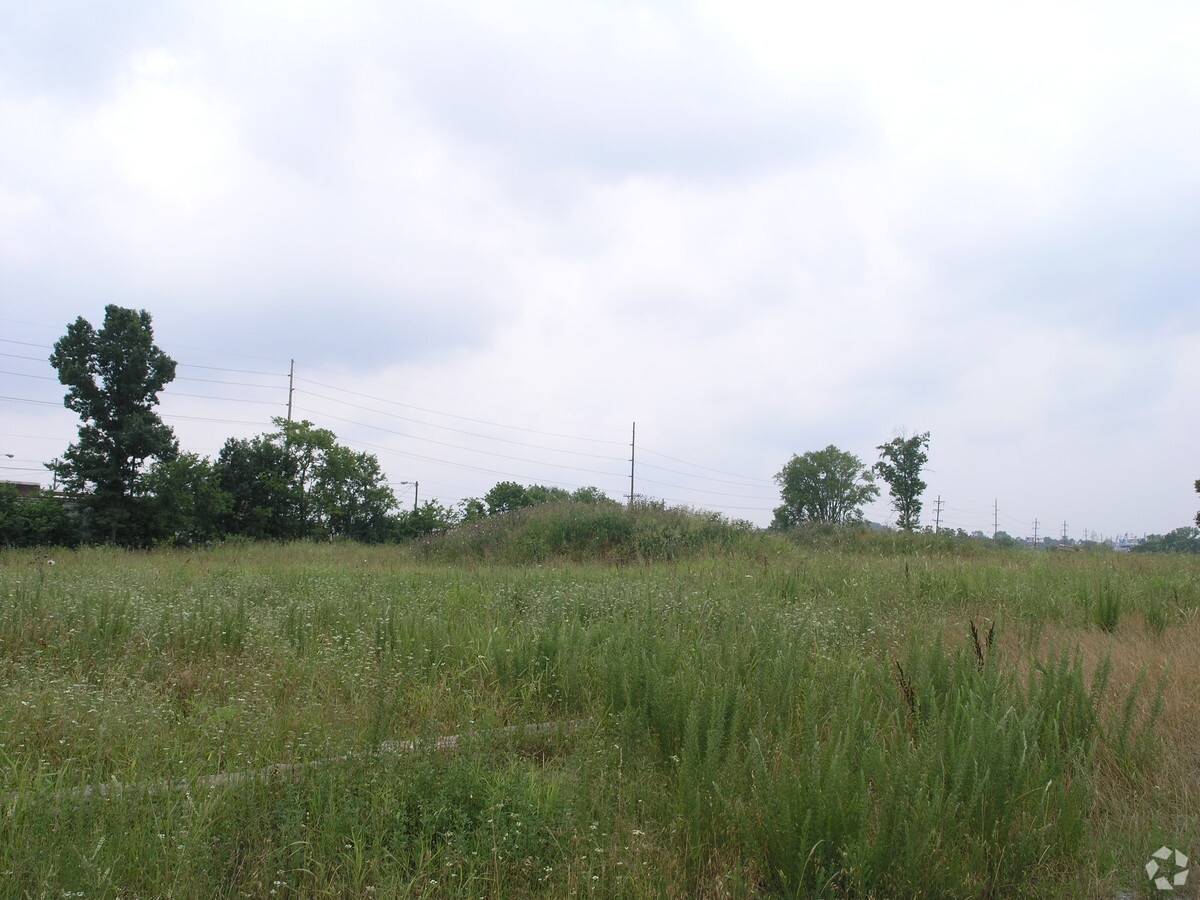
Property Record
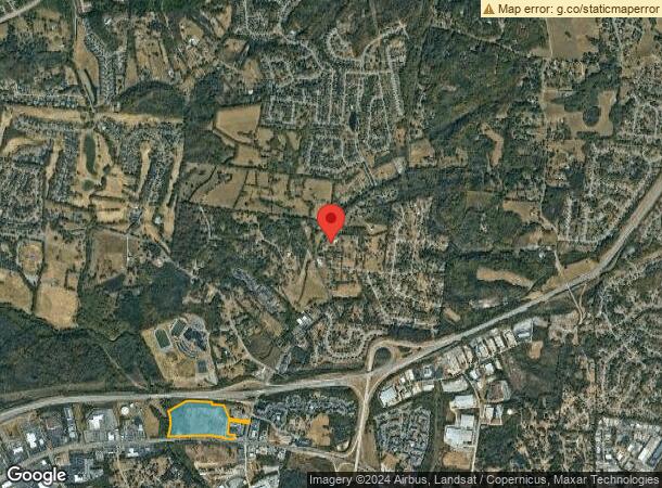
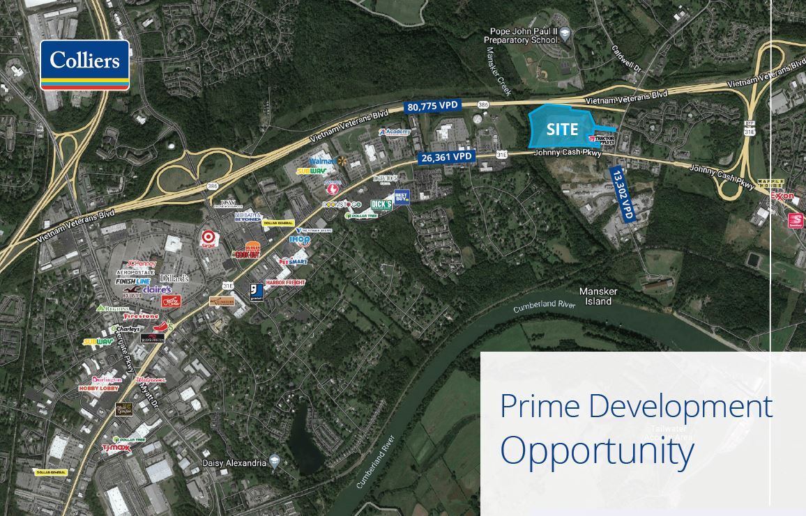
1220 Center Point Rd, Hendersonville, TN 37075
NEARBY LISTINGS FOR SALE OR LEASE
Property Detail
1220 Center Point Rd
Nashville-Davidson--Murfreesboro--Franklin, TN
Mansker Creek Sub
161-046.00
PLAT: 24 PAGE: 33 BLOCK: LOT: 2 SUBD: MANSKER CREEK SUB
Agriculturalland
Sumner
AE
Tennessee
47037C0141K
2
2023
23.19 AC
2023
Rivergate/Hendersonville
021002
Nashville
DEMOGRAPHICS near 1220 Center Point Rd
1 Mile
3 Mile
5 Mile
2024 Total Population
3,541
36,473
105,486
2029 Population
3,818
38,406
110,682
Pop Growth 2024-2029
+ 7.82%
+ 5.30%
+ 4.93%
Average Age
36
39
40
2024 Total Households
1,658
14,873
43,064
HH Growth 2024-2029
+ 7.96%
+ 5.02%
+ 4.64%
Median Household Inc
$53,562
$60,334
$63,360
Avg Household Size
2.10
2.40
2.40
2024 Avg HH Vehicles
2.00
2.00
2.00
Median Home Value
$338,095
$284,651
$294,723
Median Year Built
1995
1988
1983
Nearby Places
- Restaurants
- Banks
- Shops
- Fitness
- Groceries
PUBLIC TRANSPORTATION
AIRPORT
Nashville International
DRIVE
WALK
Distance
Nashville International
31 min
23.1 mi
Freight Ports
Port of Mobile
DRIVE
WALK
Distance
Port of Mobile
503 min
460.6 mi
SALE & LEASE HISTORY
LISTING DATE
SALE/LEASE

Sep 25, 2016
For Lease
Nearby Properties
Address
Land Use
TOTAL SIZE
Lot Size
Zoning
Address
Land Use
TOTAL SIZE
Lot Size
Zoning
4,851 SF
76.79 AC
RM4
Address
Land Use
TOTAL SIZE
Lot Size
Zoning
102,431 SF
19.59 AC
6ZZ
Address
Land Use
TOTAL SIZE
Lot Size
Zoning
3,993 SF
21.86 AC
6ZZ
Address
Land Use
TOTAL SIZE
Lot Size
Zoning
25,212 SF
31.56 AC
Address
Land Use
TOTAL SIZE
Lot Size
Zoning
3,500 SF
17.61 AC
6ZZ
Address
Land Use
TOTAL SIZE
Lot Size
Zoning
26,872 SF
24.16 AC
6ZZ
Address
Land Use
TOTAL SIZE
Lot Size
Zoning
31,919 SF
14.69 AC
Address
Land Use
TOTAL SIZE
Lot Size
Zoning
42,840 SF
21.43 AC
CS
Address
Land Use
TOTAL SIZE
Lot Size
Zoning
72,951 SF
5.31 AC
6ZZ
Address
Land Use
TOTAL SIZE
Lot Size
Zoning
12,576 SF
16.09 AC
6ZZ
Address
Land Use
TOTAL SIZE
Lot Size
Zoning
34,752 SF
19.09 AC
CS
Address
Land Use
TOTAL SIZE
Lot Size
Zoning
28,000 SF
38.86 AC
6ZZ
Address
Land Use
TOTAL SIZE
Lot Size
Zoning
86,086 SF
8 AC
OPS
Address
Land Use
TOTAL SIZE
Lot Size
Zoning
17,500 SF
17.56 AC
SCR
Address
Land Use
TOTAL SIZE
Lot Size
Zoning
32,481 SF
9.42 AC
GCS
Address
Land Use
TOTAL SIZE
Lot Size
Zoning
1,707 SF
15.03 AC
6ZZ
Address
Land Use
TOTAL SIZE
Lot Size
Zoning
185,553 SF
5.29 AC
GCS
Address
Land Use
TOTAL SIZE
Lot Size
Zoning
25,200 SF
20.36 AC
RM2
Address
Land Use
TOTAL SIZE
Lot Size
Zoning
21,356 SF
11.25 AC
6ZZ
Address
Land Use
TOTAL SIZE
Lot Size
Zoning
81,680 SF
2.87 AC
6ZZ
Address
Land Use
TOTAL SIZE
Lot Size
Zoning
78,930 SF
12.78 AC
GCS
Address
Land Use
TOTAL SIZE
Lot Size
Zoning
18,482 SF
27 AC
6ZZ
Address
Land Use
TOTAL SIZE
Lot Size
Zoning
32,296 SF
43.01 AC
6ZZ
Address
Land Use
TOTAL SIZE
Lot Size
Zoning
20,896 SF
17.79 AC
Address
Land Use
TOTAL SIZE
Lot Size
Zoning
102,396 SF
13.86 AC
6ZZ
Address
Land Use
TOTAL SIZE
Lot Size
Zoning
74,412 SF
2.26 AC
6ZZ
Address
Land Use
TOTAL SIZE
Lot Size
Zoning
15,456 SF
23.18 AC
Address
Land Use
TOTAL SIZE
Lot Size
Zoning
10,842 SF
17.25 AC
CS
Address
Land Use
TOTAL SIZE
Lot Size
Zoning
10,480 SF
17.37 AC
SP
Address
Land Use
TOTAL SIZE
Lot Size
Zoning
160,337 SF
24.22 AC
MULTI-ZONE
The World's #1 Commercial Real Estate Marketplace
Connect with us
© 2025 CoStar Group
The information above has been obtained from sources believed reliable. While we do not doubt its accuracy we have not verified it and make no guarantee, warranty or representation about it. It is your responsibility to independently confirm its accuracy and completeness. Any projections, opinions, assumptions, or estimates used are for example only and do not represent the current or future performance of the property. The value of this transaction to you depends on tax and other factors which should be evaluated by your tax, financial, and legal advisors. You and your advisors should conduct a careful, independent investigation of the property to determine to your satisfaction the suitability of the property for your needs.